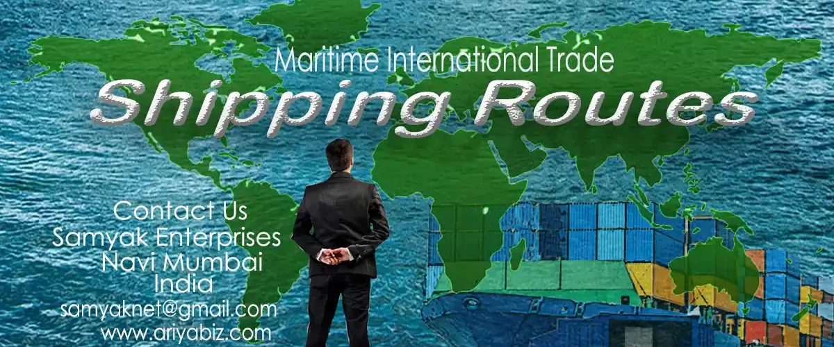
Shipping Routes: Maritime International Trade
Welcome Readers in this blog post of ‘Shipping Routes: Maritime International Trade’. Here we are going to explore important Shipping Routes, role of straits, canals and narrow waterways and major choke points. If you are looking to get into international trade of import and export operations or more about the intricacies of global commerce this blog post is for you
members of Kaushalya Panna eCommunity.
As you know world is divided in 7 Continents that’s Asia, Europe, Africa, North America, South America, Australia and Antarctica. World is in a time of globalization now. During this period of globalization, the world shrank significantly. Global trade expanded as economies opened up and colonial structures collapsed. There is a greater need than ever to transport goods across the globe as the world’s population continues to rise and demand increases. Because of this, the world’s trade is developing quickly, making cross-border logistics expertise.
Since the dawn of time, people have been trading goods both internationally and domestically. But today, we have access to a vast array of commodities worldwide because of international trade, mostly conducted by water. Almost 90% of all goods shipped worldwide are transported by sea, making maritime transportation a vital component of international trade.
Stay updated while working on shipping routes
International trade which is very profitable and draws influential people like you, by all means it is imperative to have a basic understanding of the shipping and trade industries. Keep in mind a shipping route means, ‘a sea lane that is frequently traveled by ships’.
Why are Shipping Routes important?
Usually, one of the most crucial parts of the shipping industry is trade routes. A shipping route is any path taken by commercial sea vessels. The process of figuring out how a shipment will get from an origin to a destination is called routing of ships. Shipping Routes are important because of the following points:
1) The cost of transporting cargo by water is significantly lower than that of air or land routes.
2) The most economical way to transport goods across continents is by sea.
3) Maritime shipping is the most secure and cost-effective method of shipping goods across international borders.
4) High capacity shipping allows for the bulk movement of freight by sea. Carrying large or heavy goods to distant locations or different continents is therefore preferred by sea.
5) When comparing the environmental impact of various modes of goods transportation, such as air, land, and sea transportation, maritime shipping results in the least pollution.
Understanding Global Shipping Routes
As you know, The Arctic, North Pacific, South Pacific, Indian, Southern, North Atlantic, and South Pacific oceans are the seven oceans that make up the globe. The Pacific Ocean region produces 89% of the world’s aquaculture and more than 50% of the world’s marine and river fish harvest. On the other hand, we are all impacted by the Pacific Ocean in terms of food security and climate. Half of the ocean on Earth is made up of the Pacific. In terms of trade and commerce, the Atlantic Ocean is the busiest and most significant ocean overall.
Trade route for maritime Shipping Routes in the Pacific
I. Pacific Ocean Routes
The North Pacific Sea Route
Honolulu is the meeting point of several North Pacific trade routes, besides this route connects Vancouver and Yokohama and is located on the Great Circle. Asia and the west coast ports of North America are connected by the North Pacific Sea Route. These ports are located in the Asian continent at Shanghai, Manila, Hong Kong, Kobe, Yokohama, and Singapore, and in the American region at Los Angeles, Vancouver, Portland, Seattle, and San Francisco.
The South Pacific Sea Route
The South Pacific Sea Route connects Western Europe and North America to Australia, New Zealand, and the Pacific Islands, as matter of fact it passes through the Panama Canal.
Trans-Pacific Passage: West to East
1 Far East – West Coast Route of North America
2 East Coast route, North America, Caribbean
3 Far East – West Coast of South America
4 Far East – Southeast Asia
5 Australia and New Zealand route
6 Australia and New Zealand – East and West Coast Routes of North America
Maritime Shipping Trade Route across the Atlantic
Route of the North Atlantic Sea
The North Atlantic Sea Route facilitates easy travel between the northeastern United States and the northeastern region of Europe. Globally speaking, these two are the most advanced industrialized regions.
This route accounts for a far larger portion of global trade than all the other routes combined. This maritime route handles more than 25% of all international trade, moreover consequently becomes the busiest sea route and is known as the Big Trunk Route. Both coasts have access to contemporary ports and harbor facilities.
Route of the Southern Atlantic Sea
Through this maritime route, countries in South America are connected to those in West Africa and West Europe.
The reason for the low traffic on this route is the sparse population and developing countries of South America and Africa.
Given that both South America and Africa have comparable natural resources and products to offer, there is less traffic between Rio de Janeiro and Cape Town.
II. Ocean Routes in the Atlantic
1 North America – Northwest Europe East Coast path
2 North America and Northwest Europe Caribbean-East Coast route
3 North America and Northwest Europe Asia-Pacific route: East Coast,
Mediterranean Sea, Suez Canal
4 North America, the Mediterranean, and Northwest Europe East Coast path
5 North America and Northwest Europe East Sea – Far East route – Cape of Good Hope
6: South America’s EastSea, the Cape of Good Hope, and the Far East
III. Routes in the Indian Ocean
One of the most significant international sea lanes that connects Europe and the Far East are located in the Indian Ocean. The bulk of ultra-large containerships travel on it as it travels through the Mediterranean, Suez Canal, Red Sea, Indian Ocean, South China Sea, and Strait of Malacca before arriving at the Atlantic.
The Indian Ocean is divided into five seas, which are:
Arabian Sea:
The Arabian Sea is a section of the northern Indian Ocean. It is bordered on the west by the Gulf of Aden, the Arabian Peninsula, the Guardafui Channel, and the Arabian Sea.
Bengal Bay
The Andaman Sea
Red Sea
The coasts of Yemen, Saudi Arabia, and Egypt, Sudan, and Eritrea are divided by the Red Sea.
Sea of Zanj (off the east coast of Africa) Java Sea Persian Gulf
Routes
1 via the Persian Gulf, the Good Hope, Western Europe, and North America
2: Iran – Southeast Asia – Japan
3 Transport line: Persian Gulf, Suez Canal, Mediterranean Sea, Western Europe, North America
Indian Ocean Sea Route and the Mediterranean
The Mediterranean-Indian Ocean Sea Route, which passes through the center of the ancient world, is the most efficient means of meeting the needs of people and nations.
The body of water that divides Europe, Africa, and Asia is called the Mediterranean Sea.
Mediterranean Sea
The Mediterranean Sea, which separates the continents of Africa and Eurasia, is a sea of the Atlantic Ocean.
Alboran Sea: Situated between the Iberian Peninsula and northern Africa, the Alboran Sea is the westernmost segment of the Mediterranean Sea.
Important ports include Mumbai, Port Said, Singapore, Aden, and Colombo.
This path used to go through the Cape of Good Hope. But now that the Suez Canal has taken its place, container ships can travel shorter distances and save more time thanks to it.
The following are additional Indian Ocean routes in addition to the three mentioned above: Australia and New Zealand – Mediterranean – Northwest Europe route;
Southeast Asia – East Africa route;
Far East – Southeast Asia,
Mediterranean – Northwest Europe route;
Cape of Good Hope – West Africa,
South America route;
Northern Indian Ocean – European routes
In summary, the following primary trade routes should be known to all supply chain employees.
North America – Asia
North Europe – Asia
Asia and the Mediterranean
Asia and the Middle East
North America and North Europe
East Coast of Asia Americas South
East Coast of North Europe and the Mediterranean Americas South
North America – South America’s East Coast
You may also like to read
The role of straits, canals and narrow waterways
Nile River: Burundi, Tanzania, Rwanda, Democratic Republic of the Congo, Kenya, Uganda, Sudan, Ethiopia, and South Sudan are among the ten other African nations that the Nile passes through or borders.
Nile Delta
The area in Lower Egypt where the Nile River spreads out and empties into the Mediterranean Sea is known as the Nile Delta.
The world’s longest river, the Nile, opens up into the Mediterranean Sea at the Nile Delta.
Ismailiya Canal River
The Ismailia Canal is one of the most important Nile River branches in Egypt.
Seaway of Saint Lawrence
Seaway of Saint Lawrence Connects the Atlantic Ocean and the Great Lakes and widely regarded as the most significant shipping channel in North America.
Bays
Bays are generally formed where the land curves inward; a bay is a small body of water or a wide inlet that is set off from a larger body of water.
For instance, one of the most well-known bays in the country is ‘The San Francisco Bay’, which is located off the coast of northern California. The Bay of Pigs (Cuba), Hudson Bay (Canada), Chesapeake Bay (Maryland and Virginia), and Bay of Bengal (close to India) are a few more bays.
Gulfs
Gulf is a broad body of water that is nearly entirely encircled by land, occasionally having a narrow mouth. One could think of it as a sizable bay.
World largest Gulf is Gulf of Mexico.
California Gulf
Gulf of Aden
This deepwater Indian Ocean gulf is situated between Yemen to the north and the Arabian Sea to the south. It is situated between the Red Sea and the Arabian Sea.
Persian Gulf
Persian Gulf separates Iran and Saudi Arabia and significant for global energy because oil tankers carry petroleum through its waters.
Eastern Canada is home to the Gulf of St. Lawrence.
Straits
Straits are the narrow water bodies that connect two large water bodies whereas Isthmus is a narrow strip of land that joins two larger landmasses and divides two water bodies.
They facilitate faster navigation and more efficient use of time.
The choke point
A body of water, such as a strait, is referred to as a “choke point” when it can be closed or blocked to regulate traffic routes.
Cape of Good Hope
A rocky headland on South Africa’s Atlantic coast, the Cape of Good Hope is part of the Cape Peninsula. At this Cape of Good Hope, Indian Ocean and the Atlantic Ocean meet different shades in the water appears.
The distinct hues of the water at this Cape of Good Hope make it easy to see where the Atlantic and Indian oceans converge.
Maritime straits and canals are important for sea transportation because they reduce the amount of time it takes to move cargo between ports and lower the cost of transportation. Because of their advantageous locations and economic significance, straits, canals, and narrow waterways are essential to the global maritime transportation system, enabling a considerable amount of ship movements annually.
Scotland and Ireland across the North Channel- Atlantic and Irish Seas
The English Channel
The English Channel is the Jamaica Channel, which connects Jamaica and Hispaniola to the Caribbean Sea, North Atlantic, and Strait of Dover.
Southern England and northern France are divided by the English Channel, sometimes referred to as the Channel. At its northeastern end, the Strait of Dover connects it to the southern portion of the North Sea. The world’s busiest shipping port is located there.
The English Channel’s narrowest point, known as the Strait of Dover or Dover Strait, serves as both a dividing line between Great Britain and continental Europe and the channel and the North Sea.
You may also like to read
Major chokepoint in the straits
The Hormuz Strait, spanning Iran and Oman, serves as a major chokepoint connecting the Persian Gulf, Arabian Sea, and Indian Ocean.
Bab-el-Mandeb: The Somali Peninsula’s Djibouti, Yemen, and Eritrea; the Red Sea and the Gulf of Aden
Major Chokepoint, the Strait of Malacca, Malaysia, and Sumatra, the Pacific and Indian oceans to the east and west, respectively
Bosphorus
Europe and Asia are divided by the Bosphorus. The Black Sea to the Marmara Sea
The Danish Straits: A Crucial Point of Entry
The Oresund, Great Belt, and Little Belt are the three channels that connect the North and Baltic Seas and make up the Danish Straits system. Large vessels use the Great Belt as their main route because it is the widest.
Other Important Straits
Strait of Gibraltar –
Spain, Morocco, the Strait of Gibraltar, the Atlantic and Mediterranean Seas
Palk Strait
Palk Bay/Arabian Sea in the southwest and the Bay of Bengal in the northeast make up the Palk Strait, which separates India and Sri Lanka.
Turkish Strait
The Turkish Strait separates the continents of Asia and Europe.
The adjoining Marmara Sea, the Bosporus, and the Dardanelles Straits are all referred to as the Turkish Straits.
Dardanelles Straits
The Dardanelles Straits divide Asian Turkey from European Turkey and serve as a border between the two continents.
Sunda Strait
Java Sea, the Indian Ocean, Sumatra Island, Java Island, and Sunda Strait in Indonesia
Other Straits
Lombok Strait
The Lombok Strait, which separates the Indonesian islands of Bali and Lombok, is a strait that connects the Bali Sea to the Indian Ocean.
Formosa Strait
Formosa Strait between Taiwan and China
Strait of Tartary
The Strait of Tartary in Russia (East Russia-Sakhalin Islands); – The South and East China Seas
The Okhotsk Sea and the Japan Sea
Yucatan Strait- Cuba, Mexico
Mesina Strait
The Caribbean Sea and the Gulf of Mexico
The central Mediterranean region includes the Tyrrhenian and Ionian seas, Italy, and Sicily.
Otranto Strait
Adriatic Sea and Ionian Sea; Italy and Albania
Cook Strait
South Pacific Ocean, Tasman Sea, New Zealand
Florida Strait
Florida USA, Cuba, and the Strait The Atlantic Ocean and the Gulf of Mexico
Bering Strait
Asia is separated from America by the Bering Strait, and the Arctic and East Pacific oceans
Korea Strait
Korea East China Sea and Sea of Japan Strait – Japan and South Korea
Bonifacio Strait
The Tyrrhenian Sea and the Mediterranean Sea; the French island of Corsica and the Italian islands of Sardinia; the Bonifacio Strait
Bass Strait
Bass between Tasmania’s mainland and Strait Australia: The Tasman Sea and the Great Australian Bight
Davis Strait
The Labrador Sea, Baffin Bay, and Greenland are separated by the Davis Strait in Canada.
Hudson Strait
Hudson Bay, the Labrador Sea, Baffin Island, and the Labrador Peninsula
Isthmus
Isthmus is a small strip of land that connects two larger pieces of land, with water on both sides
A narrow strip of land known as an isthmus divides two bodies of water and links two larger landmasses.
Among the main isthmuses in the world are:
Panamanian Isthmus: Middle America
Middle America’s Tehuantepec Isthmus
Kra Mainland – Isthmus Asia-Pacific
Suez Canal connecting Western Asia and North Africa
Europe’s Karelian Isthmus
Shipping Canals
Throughout the world, there are hundreds of Shipping Routes canals that vary in length, width, and depth, making it simple for a wide range of vessels to move about on a daily basis.
The Panama and Suez Canals have improved trade between the West and the East. These artificial canals serve as a great entry point for business travel by water.
Important Shipping Canals
Panama Canal – Artificial
The artificial Panama Canal spans the Panama Isthmus, a narrow strip dividing the Pacific from the Caribbean, and connects the two oceans.
The Artificial Suez Canal
Asia and Africa are divided by the canal, which links the Mediterranean Sea and the Gulf of Suez. It enables speedy travel from Europe to areas with access to the Pacific and Indian oceans.
Hangzhou-Beijing-Great Canal Canal
Canal Corinth, world’s narrowest artificial canal
The canal, which divides mainland Greece from the Peloponnese, runs through the narrow Corinthian Isthmus and links the Corinthian Gulf of the Ionian Sea and the Saronic Gulf of the Aegean Sea.
Volga-Don Canal
By connecting the Russian rivers Volga and Don, the Volga-Don Canal offers a vital waterway that connects the major oceanic networks to the Azov and Caspian Seas.
Rhine-Main-Danube Canal – Artificial
The most important Shipping Routes allows ships to move freely along the rivers between the North, Black Seas and the Atlantic Ocean that is Rhine-Main-Danube Canal .
Kiel Canal (Nord-Ostsee-Kanal) – Artificial
The North Sea-Baltic Canal – One of Germany’s principal waterways is the North Sea-Baltic Canal, also known as the Kiel Canal (named for the German city of Kiel, where it is located).
White Sea-Baltic Canal
A significant waterway that begins in the White Sea and travels through northern Russia to the Baltic Sea is known as the White Sea-Baltic Sea Canal, or simply the White Sea Canal.
Houston Ship Canal
The Houston Shipping Canal serves as a conduit between the Gulf of Mexico and Houston, Texas. It is an essential American waterway.
Danube-Black Sea Canal
Spanning Western Europe from the Danube River to the Black Sea
Other Shipping Canals
Mittelland canal
Mittelland canal is most significant transportation hub in Germany and its longest canal.
There is a connection between Western and Eastern Europe through the Central German Canal.
Caledonian Canal
Scotland’s Caledonian Canal connects Corpach, which is close to Fort William, on the west coast, with Inverness on the northeast coast, via the Glen More Valley.
Erie Canal
Connecting the Hudson River, the Atlantic Ocean, and the Great Lakes system
Khlong Canals
One of Thailand’s most significant symbols is the intricate system of canals known as Khlong.
Göta Canal
The extensive Göta Canal in Sweden connects the North and Baltic Seas.
Canal du Midi
Many travelers refer to the area around the Canal du Midi in France as “Languedoc” or “South.” The oldest canal still in use in Europe, the Canal du Midi links Toulouse and Sete, two significant cities.
Conclusion
Shipping will only continue to expand and lead to a prosperous future in global trade. Shipping routes, which are typically found close to nations with strong import and export demand, make it easier to move goods from continent to continent. We hope you can see that a sea lane, also known as a shipping lane, is a navigable route that is frequently used by large water vessels (ships) on broad waterways like lakes and oceans. It is ideally direct, safe, and affordable. Continue Reading!
Call of Action
For reliable Shipping Routes in order to plan a route effectively, it is necessary to study past routes, keep an eye on performance, and examine other important factors. Samyak Enterprises is there for this. Simply send us an email at samyaknet@gmail.com for freight forwarding. Thank You.
You may also like to read


